 |
| Driveway along Hidden Lane Landfill, Sterling; Sugarloaf Mt. on horizon |
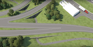
The Hidden Lane Landfill, off Persimmon Lane in Sterling, VA, pictured below, has been an EPA "brownfields" cleanup site since 2005. As cleanup proceeds to its final stages, it will soon be time for the community to help decide what will become of the site. Toward that end, there will be a public meeting, date TBD but likely in June or July this year. There will be a chance for the public to visit the site (PLEASE don't go on your own--there are still hazards from the cleanup, e.g. boreholes, and it is privately owned)
The pollutant, trichloroethene (TCE), has been found to be mainly hundreds of feet underground, possibly affecting well-water but not a significant danger at the surface--either on the landfill itself or in the wide adjacent floodplain between it and the Potomac River.
 |
| Landfill mound in foreground (darker vegetation); behind it are wide flood plain, Potomac River, and Sugarloaf Mt. |
The Potomac Heritage Trail Association views this area as a prime opportunity for the trail, both along the river and along the spine of the landfill. The views from the top are spectacular--as can be seen in the first two photos. The road atop the landfill appears to be heading straight for Sugarloaf Mountain, visible on the horizon 15 miles north. From this road, which we envision as a trail to access the river, the views in all directions are mostly trees, which hide the surrounding homes.
There are still many unknowns. Any revenues from the sale of this privately-owned property would largely go toward paying for the cleanup. A conservation buyer, such as the National Conservation Trust (which has bought other brownfield sites) is one option, but a developer might try to build houses here.
Trail and open-space advocates should gear up protect this site. Stay tuned, we'll announce the meeting date as soon as available.
 |
| Entrance to Hidden Lane off Persimmon Lane. |
 |
| Aerial view of landfill mound (lower left), floodplain and river |
 |
| EPA map of site, bounded in red. Landfill mound in center, bounded in yellow |


Comments
Post a Comment